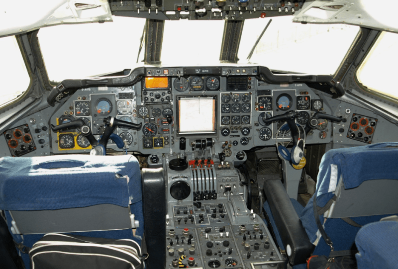
We tend take GPS navigation for granted these days, so it’s easy to forget that it became only available in the last few decades. Aviation navigation used to be significantly more challenging, so how was the Hawker Siddeley Trident, a 1960s airliner, fitted with a live updating map display? In a fascinating dive into aviation history the British Airliner Collection has spun up an insightful article on the magic behind these moving map displays.
Without access to satellite navigation or advanced electronics, engineers had to get creative. Enter the Trident’s moving map display, a marvel of ingenuity that predated the GPS systems. Using a combination of Doppler radar and some clever mechanics, pilots could accurately determine their position without relying on any external signals.
The system makes use of four Doppler radar beams, arranged in what was known as the Janus array. This configuration corrected for errors caused by changes in altitude or wind drift, ensuring accurate ground speed readings. The movable antennas mounted under the cabin floor could adjust its orientation to maintain alignment with the actual direction of travel, calculating drift angle precisely. Combined with compass information and flight time from a known start point to to indicate the current position with a pointer on a rolled paper map. The system was well ahead of it’s time, and significantly easier to use and more accurate than the Decca radio navigation system in use at the time.
It’s mind boggling to see the solutions engineers came up with without much of the digital technology we take for granted today. Gyroscopes for inertial navigation, the cavity magnetron for radar and radial engines were all building blocks for modern aviation.
Thanks for the tip [poiuyt]!
0 Commentaires